Order 2 or more products and get €10 off and a FREE Adventure Map of Ireland worth €15!
0
€0.00
Order 2 or more products and get €10 off and a FREE Adventure Map of Ireland worth €15!

€10.00
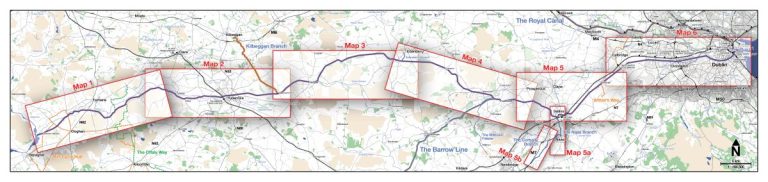
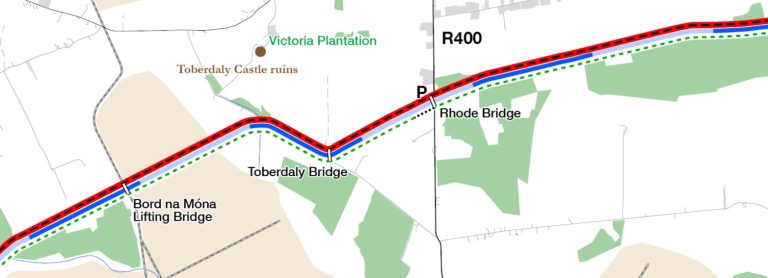
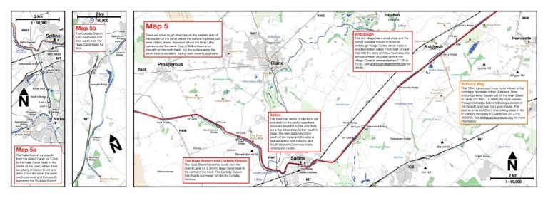
This detailed map of the Grand Canal has been created specifically for walkers, cyclists and paddlers. It includes up-to-date information on the surface of the towpaths, local amenities and information on the routes that pass near the canal. It has been designed for both planning and navigation and consists of a large-scale (1:164,500) overview map and 8 detailed (1:50,000) insert maps.
The paper map is printed in Ireland on 110gsm paper and is 100cm x 35.5cm, folding down to 17.7cm x 12.5cm.
Order Cycling in Ireland now and get this map for FREE!
This detailed map of the Grand Canal has been created specifically for walkers, cyclists and paddlers. It includes up-to-date information on the surface of the towpaths, local amenities and information on the routes that pass near the canal. The map has been designed for both planning and navigation.
It consists of a large-scale (1:164,500) overview map and 8 detailed (1:50,000) insert maps and is printed in Ireland on 110gsm paper and is 100cm x 35.5cm, folding down to 17.7cm x 12.5cm.
| Product | Category | Weight (grams) | Island of Ireland | UK and EU | Canada (not US) | Rest of the world |
|---|---|---|---|---|---|---|
| Greenways of Ireland | Book | 550g | €3 | €14 | €24 | €28 |
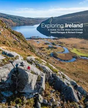
| Exploring Ireland | Book | 796g | €3 | €14 | €24 | €28 |
| Cycling in Ireland | Book | 541g | €3 | €14 | €24 | €28 |
| Exploring Ireland’s Wild Atlantic Way | Book | 507 | €3 | €14 | €24 | €28 |
| Bouldering in Ireland | Book | 569g | €3 | €14 | €24 | €28 |
| Bouldering Essentials | Book | 478g | €3 | €11 | €17 | €23.50 |
| Rock Climbing in Ireland | Book | 414g | €3 | €11 | €17 | €23.50 |
| The History Map of Ireland – Poster | Poster | 415g including tube | €3 | €11 | €17 | €23.50 |
| The Adventure Map of Ireland – Poster | Poster | 415g including tube | €3 | €11 | €17 | €23.50 |
| The Adventure Map of Ireland – Folding Map | Folding Map | 150g estimated | €3 | €7 | €10 | €12 |
| The Cycling Map of Ireland – Poster | Poster | 149g including tube | €3 | €9.50 | €14 | €18.50 |
| The Hiking Map of Ireland – Poster | Poster | 149g including tube | €3 | €9.50 | €14 | €18.50 |
| The Wild Atlantic Way Map – Poster | Poster | 149g including tube | €3 | €9.50 | €14 | €18.50 |